The best way to know what a boundary survey cost in South Australia will be is to ask a licensed surveyor or surveying firm for a quote. A boundary survey does not always attract a standard fee and prices can vary from property to property and street to street.
In this article we will explain some of the most common factors that contribute to the boundary survey cost in South Australia to help you review your quote and to make sure you are choosing a surveyor that provides you with an accurate cost for the surveying work that you need.
We have previously explained some ways that may help to reduce the boundary survey cost in 6 simple ways to make your boundary survey cheaper. By using this guide (and others we prepare) we hope that they will help you get the best service for your land surveying needs.
[mc4wp_form id=”647″]

Page Contents
The Factors Contributing to Boundary Survey Costs
Hierarchy of Evidence and the Boundary Survey Cost
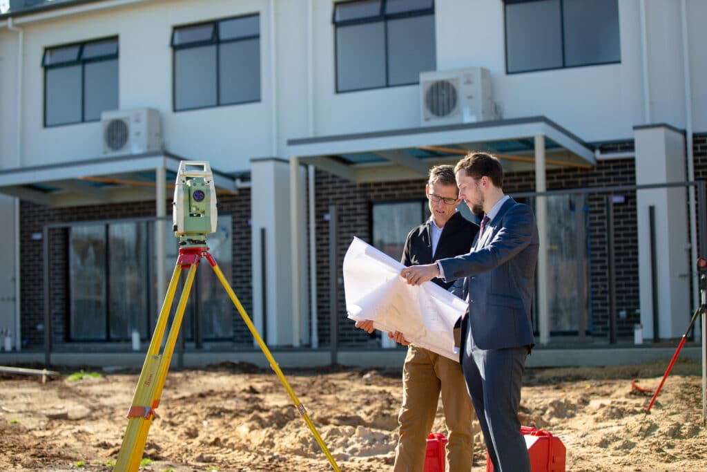
First of all, it is important to understand what a Licensed Surveyor needs to look for to define the boundaries of your property.
The list below is ranked from the most important evidence to the least important.
- Natural Boundaries (Rivers, watermarks etc.)
- Original Survey Marks
- Data from Original Marks
- Long Established Occupations (old fences, buildings/walls etc.)
- Occupations in General
- Data
Age of the Existing Survey Data
Many suburbs in Adelaide were developed prior to the early 1900s and surveying has progressed to be far more accurate since that time.
In the early 1900s and before that, there was no requirement for reference marks to be placed in the ground or on a survey plan. Reference marks such as metal pins or survey pegs can be used to define the boundary.
Boundary marks were placed by the original surveyor, but most of the time a surveyor will need to use data such as old fences or walls. If evidence conflicts with the data on your title, the boundary survey cost will likely be higher.
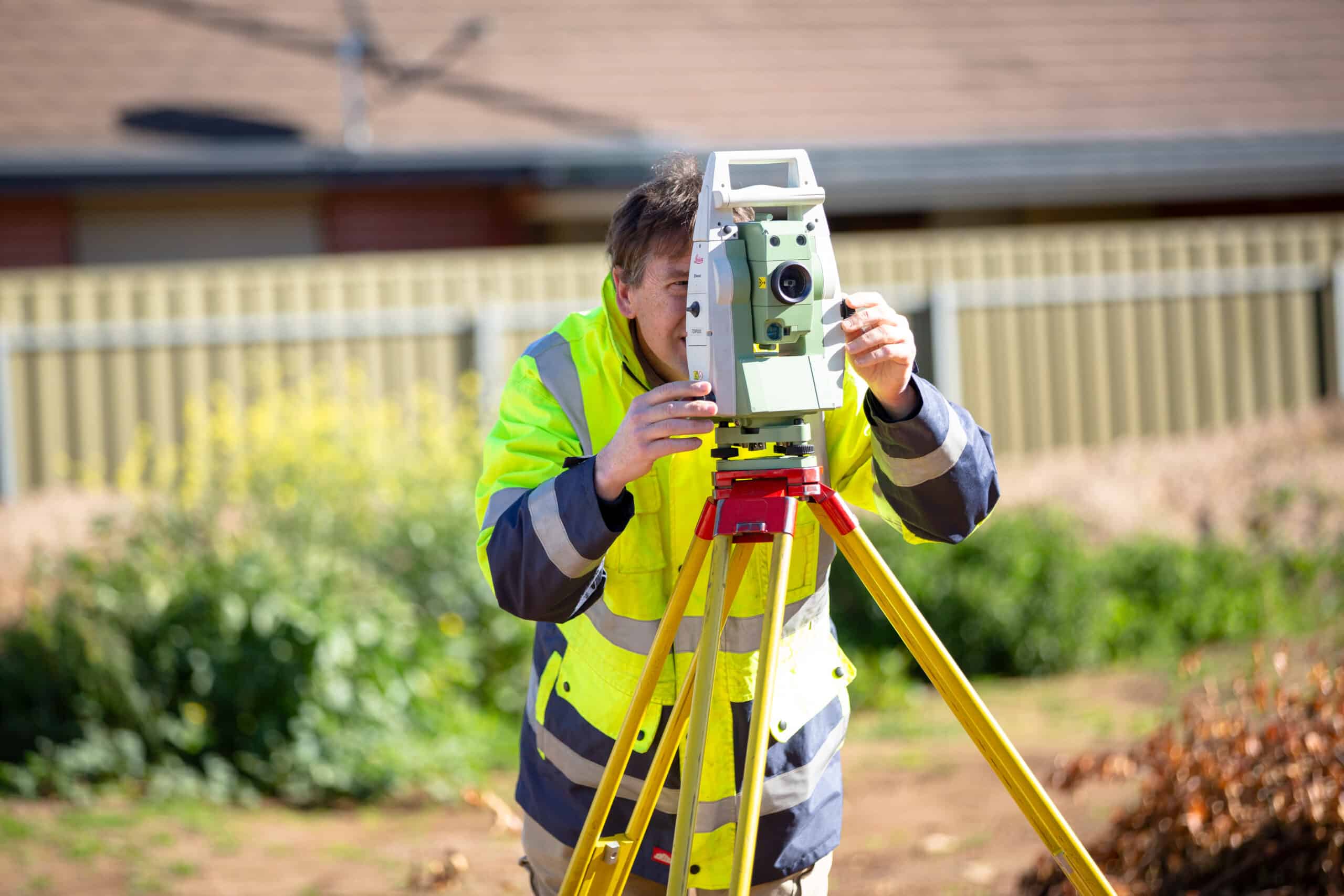
The quality of measurements has improved over time as well. Land Surveying equipment gets better and better and more accurate. This may have an impact on what was thought to be the boundary location.
As land surveying equipment becomes more accurate, inconsistency in measurements in old survey plans are discovered and a Licensed Surveyor needs to make a decision on the boundary location based on other evidence. All of this will affect the cost of a boundary survey.
Paper/Data Plans
There was a period of time where plans known as data plans or paper plans were quite common to create new allotments and the boundaries were not always physically marked on the ground.
Data Plans are often able to be prepared without the need to do any work on the site or place any survey marks. These were probably prepared in order to reduce the boundary survey costs.
Land Titles were created and boundary positions determined simply by looking at other survey plans and not using any of the top 5 points in the boundary data hierarchy above.
The existence of data plans has created a significant risk in the possibility of boundary disputes occurring. A data plan that was drawn did not necessarily take into account the amount of land which is physically available on the ground.
Most boundary survey plans and land division plans now do require survey evidence to be shown and marks to be placed so it is no longer possible to just prepare a plan without marking those boundaries.
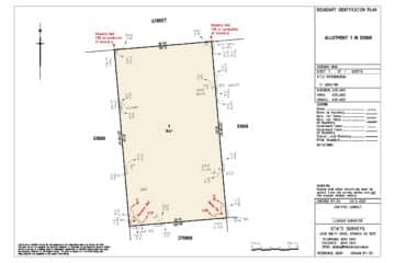
Permanent Survey Marks
Permanent survey marks are placed and used by Licensed Surveyors as major reference points and assist in defining the location of property boundaries.
Permanent Survey marks are stable marks placed in the ground (often found in the footpath in urban areas, or the verge in most areas) that are fixed to boundary corners by measurement.
Most subdivision plans required permanent survey marks to be placed and if those marks still exist nearby your property, it is quite simple for a licensed surveyor to reference the intended location of your boundary.
The existence of original permanent survey marks near your property will help to reduce the boundary survey cost.
Because of their location, unfortunately the permanent marks are often accidentally removed or disturbed by building work in the road or verge. As these marks are removed, the boundary survey costs will unfortunately continue to increase.
Recent Surveys in the Area
Sometimes another surveyor may have already undertaken a survey nearby and prepared a plan with information that assists with all future surveys in the area.
Where the data shown on your Certificate of Title conflicts with the evidence available to define the boundary, it is helpful if another Licensed Surveyor has already answered these conflicts.
In the case that the conflicts have already been resolved, the boundary survey cost for your property will be lower than if they need to be investigated as part of your survey.
Licensed Surveyors can use evidence from other surveyors’ recent plans in the same area to help define the location of your property boundary.
Reason for the Survey
The reason for the survey of your property can affect the total boundary survey cost.
If you are only building near one boundary and only require that boundary to be surveyed, this does in some cases significantly reduce the scope of the work and therefore the cost.
Boundary disputes will likely require more evidence to be shown on the plan to help represent the location of the boundary. This will increase the boundary survey cost as the Licensed Surveyor will need to spend more time locating the evidence for the plan.
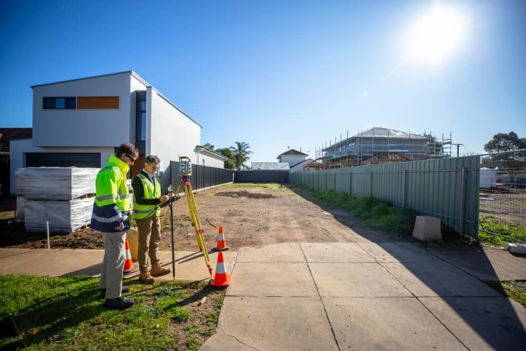
Access to the Site
Licensed surveyors are professionals with many years of experience and significant expertise in their field. If a land surveying firm sends their surveyor all the way to your site and the gates are locked or we cannot access the property, they will need to charge a site visit fee in much the same way as lawyers and doctors charge for no-show appointments.
Similarly, if parking is not available near your site in a busy area such as the city, the survey team will need to walk a long way with their equipment which adds time to the survey and increases that component of the boundary survey cost
If access to the site is possible, but some areas of the boundary are not accessible it makes it much harder to define the boundary in some cases.
If some areas of your property cannot be accessed but are required to help define a boundary, we need to travel around the entire street block to measure the evidence required to define the boundaries.
Existing structures on the site will also add to the number of times the surveyor’s equipment needs to set up and checked. This adds time and money to the job which affects the boundary survey cots.
A licensed surveyor needs access to the boundary corners to mark them, if they can’t then either the boundary is not being marked or you are paying a surveyor to do your manual labour.
Slope of the Site
Boundary surveys in hilly areas can sometimes attract a higher boundary survey cost.
Sites with significant hills and slopes are often sites where access is difficult and in which it requires a higher level of fitness/endurance than others.
This, coupled with the location of evidence of the boundary and its accessibility with all the surveying equipment to be carried makes the survey harder and take longer than a flatter site.
Land Surveying equipment also often needs a direct line of sight to reference points that they set up when surveying land.
Hills often get in the way of a line of sight and often mean the surveyor will need to add a number of equipment setups in order to define your boundary location. This adds time to survey and ultimately increases the boundary survey cost.
Size of the Property/Corners on block
A rectangular or square property requires a minimum of 4 boundary markers to be placed to show the location of all 4 boundaries.
If, however, your property has more than 4 boundaries, more boundary markers are required to be placed to show their locations. More resources will add to the boundary survey cost as well as the time it takes to finish the survey.
Similarly, If your property is large, it will take more time to check and survey the boundaries and travel between them. The longer the survey takes a licensed surveyor, the higher the cost of the boundary survey will be.
Number of Boundaries to be Surveyed
If you are only building on one boundary then the extent of the survey is less and can sometimes significantly reduce the scope and cost of the survey.
There are sometimes cases where some of your boundaries are easier to define than others. If your licensed surveyor only needs to show you the location of the “easy” boundaries then they want to know.
You can save money by only getting the boundary that you are building on or near surveyed and marked.
In some cases, this won’t make much of a difference but if we know exactly what you are proposing and the extent of the survey that you want, we can advise accordingly.
Time-frame
Some licensed surveyors may be very busy and will need to prioritise their work. If you are hoping to have your land surveyed and marked in a short time frame, a higher boundary survey cost may be added to your job to fit you in.
Particularly in rural areas, if you are not in any hurry for your survey to be done, tell your surveyor and they can fit you in with a similar survey in your area in a few weeks’ time. This will hopefully reduce the boundary survey cost as you can save on the travel fees to the site.
Contact Us
Get in contact with our team today to provide a free quote for your boundary surveying needs.
Our professional staff are knowledgeable and approachable. We are here to help and will point you in the right direction.